
BTMETER BT-100WM
4.1Editor score
Measures wind speed
Logs barometric data
Backlit LCD screen
Finding the right handheld altimeter is crucial for outdoor enthusiasts who need reliable elevation data. Whether you are hiking high peaks or navigating trails, accurate altitude readings help ensure safety and route planning efficiency.
We compared ten distinct models ranging from analog to digital options. Our evaluation focuses on accuracy, durability, battery life, and ease of use to help you make an informed decision for your next outdoor expedition.
Each pick highlights specific strengths and ideal use cases for different adventurers. Please note that prices and availability can change frequently so verify current details before purchasing to ensure you get the best value.
4.1Editor score

4.6Editor score
4.3Editor score
As an Amazon Associate we earn from qualifying purchases.
The following table provides a side-by-side comparison of all ten reviewed products. This view helps you quickly identify key specifications and features to determine which model aligns best with your specific outdoor needs.


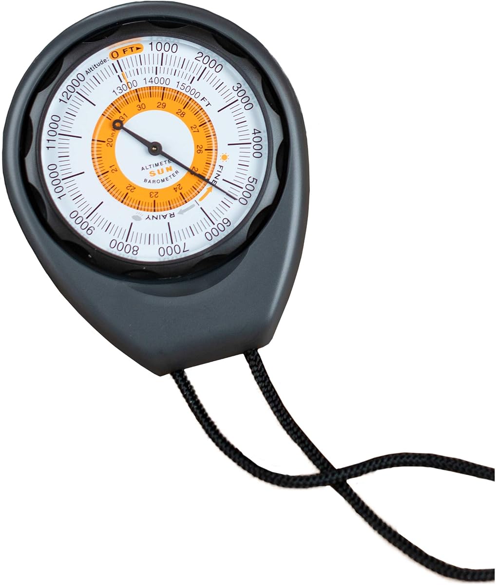
The Sun Company Altimeter 203 stands out as a reliable analog tool for hikers seeking simplicity. It holds a solid rating and excels in providing quick altitude checks without relying on batteries or electronics.
We may earn a commission when you buy through this link, at no additional cost to you.
Its rugged ABS case protects the internal mechanism during outdoor activities. The adjustable dial allows users to calibrate for barometric pressure changes ensuring accurate readings across different terrains and weather systems.
While it lacks digital features the analog design ensures longevity and reliability. The trade-off is that it requires manual adjustment and may be slightly less precise than high-end digital models in rapidly changing conditions.
This device is ideal for backpackers who want a backup tool alongside GPS. We recommend it for those prioritizing durability and simplicity over advanced data logging capabilities.
The analog mechanism ensures you never run out of power mid-trip.
The ABS housing withstands drops and rough handling in outdoor environments.
We may earn a commission when you buy through this link, at no additional cost to you.
The BTMETER BT-100WM offers exceptional value for those needing more than just altitude data. It measures wind speed and barometric pressure making it a versatile tool for hikers and shooters.
We may earn a commission when you buy through this link, at no additional cost to you.
Its digital display is backlit for easy reading in low light conditions. The data logging feature allows you to track pressure changes over time which is useful for predicting weather shifts.
However it relies on batteries which can be a downside for long expeditions. The wind sensor is also exposed so care must be taken to avoid damage in extreme wind conditions.
We suggest this model for budget-conscious users who need comprehensive weather data. It strikes a good balance between functionality and cost for general outdoor use.
Beyond altitude it measures wind speed and humidity for comprehensive weather tracking.
Record pressure changes to analyze trends and predict incoming weather systems.
We may earn a commission when you buy through this link, at no additional cost to you.
This compact device combines eight functions into one handheld unit suitable for casual hikers. It provides essential data like altitude temperature and direction in a single package.
We may earn a commission when you buy through this link, at no additional cost to you.
The electronic compass helps with orientation while the altimeter tracks elevation changes. The backlight ensures visibility in shaded areas or early morning hikes.
Users report that the accuracy is basic compared to premium models. It serves well for general hiking but may not be precise enough for professional surveying.
We recommend this for casual users needing a simple all-in-one tool. It is a good entry-level option for those new to altitude monitoring.
Combine compass thermometer and altimeter functions to save space in your pack.
The lightweight build ensures it does not add significant weight to your gear.
We may earn a commission when you buy through this link, at no additional cost to you.
This model is similar to the previous entry but offers a slightly improved rating. It covers a wide altitude range making it suitable for high-elevation hikes.
We may earn a commission when you buy through this link, at no additional cost to you.
The digital display shows multiple metrics simultaneously which is convenient for quick checks. The backlight ensures readability during twilight hikes.
Build quality is basic and it may not withstand extreme abuse. Calibration is necessary to ensure accurate readings over time.
We recommend this for hikers needing a budget-friendly all-in-one solution. It is ideal for occasional use rather than daily professional reliance.
Track elevation from below sea level to high mountain peaks easily.
View temperature and pressure without switching modes for efficiency.
We may earn a commission when you buy through this link, at no additional cost to you.
The AltiLINQ is designed specifically for vehicle use but works as a handheld too. It offers reliable analog readings without the need for batteries.
We may earn a commission when you buy through this link, at no additional cost to you.
It mounts easily to a dashboard allowing drivers to monitor altitude changes on road trips. The adjustable dial ensures accuracy across different regions.
While portable it is best optimized for vehicle mounting. Manual calibration is required which can be less convenient than digital auto-calibration.
We recommend this for travelers who need elevation data during car trips. It is a great addition for road trips through mountainous terrain.
Keep track of elevation changes effortlessly while driving on mountain roads.
Reliable operation ensures it works whenever needed without checking power levels.
We may earn a commission when you buy through this link, at no additional cost to you.
This device focuses on high-precision measurement of height and slope. It is ideal for forestry or construction applications where accuracy is paramount.
We may earn a commission when you buy through this link, at no additional cost to you.
The aluminum body is waterproof and shockproof ensuring durability in rough conditions. The sighting lens allows for precise angles and heights.
It lacks digital features and requires manual aiming which takes practice. However for professional use the accuracy outweighs the inconvenience.
We recommend this for professionals needing reliable field measurements. It is a robust tool for surveying or forestry work.
Accurate measurements for critical field work ensure reliable project data.
The aluminum construction withstands harsh environmental conditions effortlessly.
We may earn a commission when you buy through this link, at no additional cost to you.
The Garmin GPSMAP 65s is a top-tier device for serious adventurers. It combines GPS navigation with a barometric altimeter for precise elevation data.
We may earn a commission when you buy through this link, at no additional cost to you.
Multi-band satellite support ensures optimal accuracy even in dense forests or urban canyons. The sunlight-readable color display is easy to use outdoors.
It is more expensive than basic models and relies on batteries for long trips. However the features justify the cost for professionals.
We recommend this for outdoor professionals needing reliable navigation. It is the best choice for complex backcountry expeditions.
Enhanced signal reception ensures accurate positioning in challenging environments.
Routable TopoActive maps provide essential topographic details for planning.
We may earn a commission when you buy through this link, at no additional cost to you.
This tool integrates altitude temperature and barometric data into a tiny package. Its rating indicates high user satisfaction due to convenience.
We may earn a commission when you buy through this link, at no additional cost to you.
The carabiner clip allows for hands-free carrying on backpacks or belts. It also includes a weather forecast feature for planning ahead.
It is less accurate than professional models but sufficient for general hiking. The compact design ensures it fits easily into any pocket.
We recommend this for casual hikers needing quick checks. It is a versatile addition for those prioritizing portability.
Attach the clip to your pack for immediate access without holding it.
ABS construction protects the device while keeping weight minimal.
We may earn a commission when you buy through this link, at no additional cost to you.
This analog model offers a compact solution for measuring slope and height. It is built with aluminum ensuring it survives drops and bumps.
We may earn a commission when you buy through this link, at no additional cost to you.
Being battery-free it is always ready to use without worrying about power. The included soft case protects it in your gear.
The dial is small which may be harder to read for some. However it is sufficient for general field use.
We recommend this for explorers needing a robust backup tool. It fits well in a pocket for immediate access.
No electronics means no failure in extreme cold or wet conditions.
Protective storage ensures the device remains scratch-free when not in use.
We may earn a commission when you buy through this link, at no additional cost to you.
This device integrates GPS tracking with altitude monitoring for comprehensive fitness data. It includes a pedometer making it useful for tracking steps as well.
We may earn a commission when you buy through this link, at no additional cost to you.
The USB rechargeable battery reduces the need for replacements. It also features a built-in flashlight for emergency situations.
However the rating is lower than competitors which may indicate reliability issues. The interface can be complex to navigate for new users.
We recommend this for fitness enthusiasts needing extra data. It is a budget-friendly option for those wanting GPS features.
Combine elevation data with step counting for comprehensive workout analysis.
The LED flashlight adds a layer of safety during night walks.
We may earn a commission when you buy through this link, at no additional cost to you.
Selecting the right altimeter depends on your specific outdoor needs and technical preferences. This guide outlines the critical factors to consider before making a purchase.
Precision varies significantly between analog and digital models. Digital units with barometric sensors usually offer finer resolution for elevation changes than analog dials. If you are scaling technical routes high accuracy is vital for safety.
Prioritize models with calibration features to maintain accuracy over time.
Analog devices often operate without batteries ensuring they work regardless of power status. Digital models provide advanced features but rely on batteries which can fail during long trips. Consider carrying spare batteries if choosing digital options.
Choose battery-free analog tools for remote trips where charging is impossible.
Outdoor gear faces harsh conditions including rain and drops. Look for waterproof designs and rugged materials like aluminum or reinforced ABS. A protective case is essential to prevent damage during transport.
Select durable builds with protective cases for rough field environments.
Many modern altimeters offer compasses thermometers and weather forecasts. These multifunctional tools reduce the load on your pack by combining several instruments. Ensure these features are reliable rather than just add-ons.
Multi-function devices save pack space if all metrics are reliable.
The display must be legible in direct sunlight or low light. Digital units with backlighting are useful in shaded areas but require power. Analog dials should have clear markings to avoid reading errors.
Ensure clear markings or backlighting for legibility in all light.
Complex interfaces can hinder quick data retrieval during a hike. Models with intuitive controls allow you to check elevation without stopping. Manual calibration should be straightforward to avoid user error.
Choose intuitive interfaces to minimize setup time during hikes.
Weight and size are critical factors for long-distance hikers. Pocket-sized devices are easier to carry but may lack large displays. Consider mounting options for vehicle use if applicable.
Prioritize lightweight designs for backpacking and long-distance hiking.
Budget models offer basic functionality while premium units provide GPS and mapping. Determine what features are necessary for your specific activities. Spending more ensures reliability but avoid paying for unused features.
Balance your budget with necessary features for your hiking style.
To ensure accuracy calibrate the device before starting your hike. Set the altimeter to a known elevation or use local weather pressure data as a reference point. This helps correct any drift caused by atmospheric changes.
Avoid exposing digital units to water unless they are explicitly rated waterproof. Store devices in protective cases when not in use to prevent scratches or impacts. Keep them away from extreme temperatures that might damage internal components.
Regularly check the battery levels on digital models to avoid unexpected shutdowns. For analog devices inspect the dial and housing for signs of wear. Proper care extends the lifespan of your equipment significantly.
Most handheld altimeters use a barometric pressure sensor to estimate elevation. As you ascend atmospheric pressure drops allowing the device to calculate height based on standard models. GPS units use satellite data for position but pressure sensors are more accurate for elevation changes.
Yes calibration is essential for maintaining accuracy. Changes in local weather pressure can cause readings to drift. For best results recalibrate at the start of each hike using a known elevation point or local weather station data.
Digital models offer features like logging and compasses but rely on batteries. Analog devices are more reliable as they do not need power. The choice depends on whether you prioritize advanced features or simplicity.
Standard altimeters are designed for air pressure and do not work underwater. For depth measurement you need a depth gauge which operates differently. Using a barometric altimeter underwater will yield incorrect and potentially dangerous readings.
Most handheld models cover ranges from below sea level to around 15,000 to 30,000 feet. This is sufficient for almost all hiking and mountaineering activities. Check the specific model's max range before purchasing for high-altitude expeditions.
Altimeters with barometric sensors are generally more accurate for elevation than standard GPS units. GPS relies on satellites and can have vertical errors of several meters. Barometric sensors provide finer detail on steep terrain and changes.
We have explored ten distinct models ranging from budget-friendly digital tools to premium GPS units. Each offers unique strengths whether you need simple analog reliability or advanced multi-function capabilities.
Prioritize durability and calibration ease to ensure your device serves you well on trails. Consider your specific activity level to decide between simple tools and complex gadgets.
Remember to verify the current price and availability before purchasing as stock varies frequently. Choosing the right device ensures safer and more informed outdoor adventures.