
Garmin eTrex SE
4.2Editor score
Long battery life up to 168 hours
Multi-GNSS support for better tracking
Water-resistant design rated to IPX7
Navigating the open water requires precision and reliability. A dedicated GPS for Sailing provides essential tools like chartplotting, waypoint tracking, and safety alarms. Choosing the right device ensures you stay on course and safe during every voyage.
We analyzed ten leading marine GPS models to identify the best options for sailors. Our comparison focuses on display quality, satellite support, battery endurance, and specialized sailing features. This list covers handheld units and fixed chartplotters for every vessel size.
Each pick highlights key strengths and potential trade-offs to aid your decision. Ratings reflect user feedback and technical performance. Please note that availability and pricing fluctuate regularly, so verify current details before purchasing your new navigation system.
4.2Editor score

4.0Editor score

5.0Editor score
As an Amazon Associate we earn from qualifying purchases.
This side-by-side comparison breaks down the core specifications of every model on our list. We highlight display size, memory capacity, satellite support, and unique marine features to help you differentiate between rugged handhelds and advanced chartplotters.




The Garmin GPSMAP 79sc stands out as a reliable handheld GPS for Sailing with its rugged design and preloaded BlueChart g3 coastal charts. It holds a solid rating from users who value durability and essential marine features. Its standout qualities include a floating body that prevents loss overboard and a high-resolution display that remains readable in sunlight.
We may earn a commission when you buy through this link, at no additional cost to you.
This device supports multiple satellite constellations like GPS, GLONASS, and Galileo, ensuring reliable tracking around the world. The built-in 3-axis tilt-compensated electronic compass shows heading even when the unit is standing still. Additionally, the barometric altimeter tracks pressure changes to help pinpoint precise altitude during coastal approaches or island hopping.
While the unit offers excellent durability with IPX6 water resistance at the unit level, users should be aware this rating does not cover submersion. The battery life reaches up to 20 hours in GPS mode, which is sufficient for most day trips but may need monitoring on extended voyages in colder temperatures.
Sailors looking for a balance of preloaded marine maps and portability will find this an ideal companion. The ability to save 10,000 waypoints and 250 routes provides ample data for complex coastal trips. It is the recommended choice for recreational sailors needing a dependable handheld navigational tool.
The preloaded BlueChart g3 coastal charts allow immediate navigation without needing to purchase separate map cards for standard routes.
Support for GPS, GLONASS, Beidou, Galileo, and QZSS ensures strong signal acquisition even in areas with obstructed skies or challenging terrain.
We may earn a commission when you buy through this link, at no additional cost to you.
The Garmin GPSMAP 65s is designed for those needing optimal accuracy in challenging locations. It features expanded global navigation satellite systems and multi-band technology to maintain signal strength in urban canyons or dense forests near shorelines. The large 2.6-inch sunlight-readable color display makes viewing data easy during bright daylight sailing conditions.
We may earn a commission when you buy through this link, at no additional cost to you.
Navigation is supported by routable TopoActive mapping and a barometric altimeter for precise elevation tracking. You can manage tracks and routes using the Garmin Explore website and app if you have a compatible smartphone. This connectivity allows for reviewing statistics from the field and planning future trips with ease.
Although the federal public land map is included, it is restricted to users in the United States, which may limit utility for international sailors. The multi-band technology significantly improves tracking reliability in difficult environments but relies on updated firmware for best performance.
Sailors who frequently dock near urban areas or forests should appreciate the enhanced GPS reliability. The combination of physical buttons and a large display ensures usability even with wet hands. This unit is best suited for those who want detailed mapping and modern connectivity features.
Multi-band GNSS allows you to get optimal accuracy in challenging locations, including steep country, urban canyons and forests with dense trees.
Compatible with the Garmin Explore website and app to help you manage tracks, routes and waypoints and review statistics from the field.
We may earn a commission when you buy through this link, at no additional cost to you.
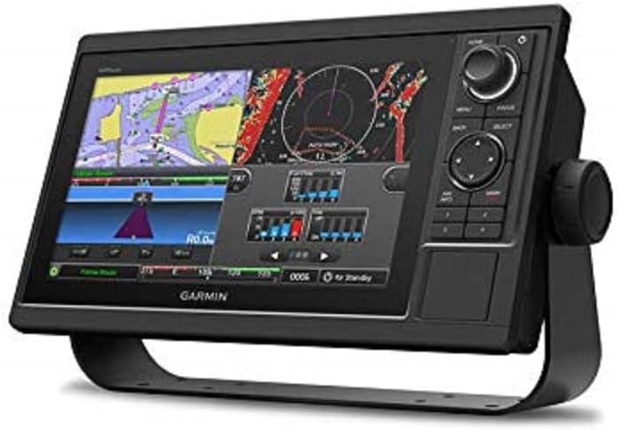
The Garmin GPSMAP 1022 offers a substantial fixed display solution for larger vessels. Its 10.1-inch WSVGA display provides a clear view of charts and data at a glance. This unit accepts two SD cards, allowing users to expand mapping options significantly beyond the included worldwide basemap.
We may earn a commission when you buy through this link, at no additional cost to you.
Equipped with two Garmin Marine Network Ports, this chartplotter integrates well with other onboard systems like radar or depth sounders. The physical dimensions are optimized for standard mounting locations on a helm station. The worldwide basemap ensures basic navigation is possible out of the box.
While it excels in screen real estate, users must consider the need for permanent installation rather than handheld convenience. The dual SD card slots are crucial for storing high-resolution marine charts which are not included in the base unit cost.
For sailors who need a reliable central navigation screen to share with crew members, this model delivers. The ability to connect to the marine network makes it a versatile choice for complex boat systems. It is best for those planning extended coastal voyages with multiple data inputs.
Accepts two SD memory cards so you can store extensive chart data and custom waypoints without worrying about running out of space.
Two Garmin Marine Network Ports allow you to connect to compatible sensors, radar, and other marine electronics for a unified system.
We may earn a commission when you buy through this link, at no additional cost to you.
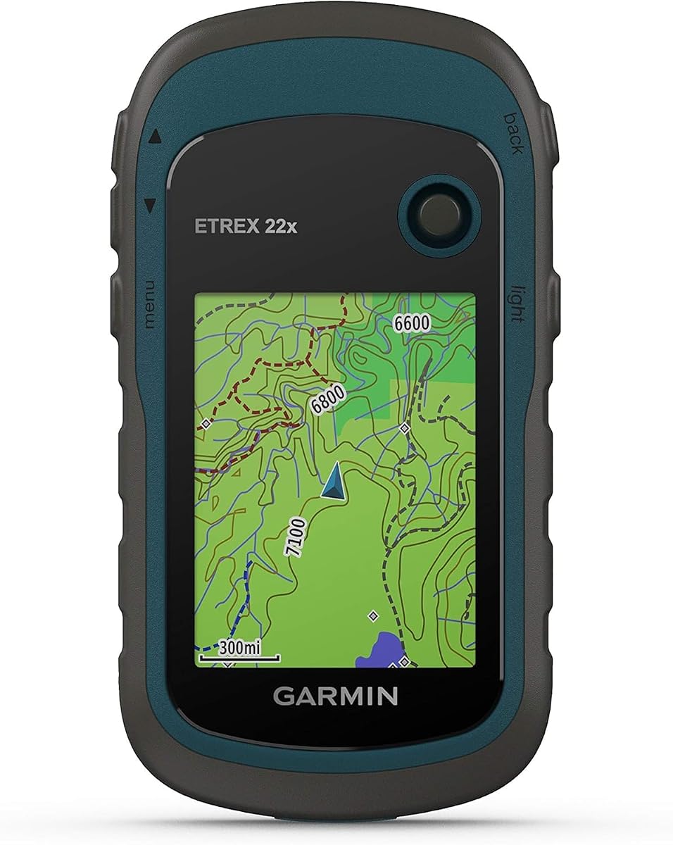
The Garmin eTrex 22x is a rugged handheld GPS that delivers impressive endurance for long days at sea. It offers up to 25 hours of battery life in GPS mode using two AA batteries. The device includes a 2.2-inch sunlight-readable color display that improves readability during bright conditions.
We may earn a commission when you buy through this link, at no additional cost to you.
Preloaded Topo Active maps provide routable roads and trails which can assist with shore excursions or port visits. It supports GPS and GLONASS satellite systems for tracking in more challenging environments than GPS alone. The 8 GB of internal memory provides space for additional map downloads via a micro SD card slot.
While the maps are often oriented toward land trails, the rugged build quality and long battery life make it a reliable backup device. The smaller screen might require squinting in direct sunlight compared to larger handhelds. However, its lightweight nature makes it easy to carry as a secondary navigator.
For sailors who hike inland during port stops or need a backup with massive battery endurance, this device is a strong contender. The combination of satellite support and physical durability ensures it remains functional even when conditions are rough. It is a practical choice for budget-conscious adventurers.
Battery life reaches up to 25 hours in GPS mode with 2 AA batteries ensuring you stay navigated through long voyages without frequent replacements.
Support for GPS and GLONASS satellite systems allows for tracking in more challenging environments than GPS alone for reliable positioning.
We may earn a commission when you buy through this link, at no additional cost to you.
The Garmin GPS 73 is designed specifically with sailors in mind, offering unique SAILASSIST features like virtual starting lines and countdown timers. It supports long battery life with over 18 hours of operation on 2 AA batteries. The device includes essential marine features such as Man Overboard (MOB) alerts and route planning.
We may earn a commission when you buy through this link, at no additional cost to you.
An intuitive user interface with dedicated backlit buttons allows for quick and easy operation even in rough conditions. It stores up to 1,000 waypoints and 100 tracks to help you return to favorite spots or safe harbors. The marine alarms include notifications for going off course or anchor dragging.
While the technology is not as advanced as newer chartplotters, the specific sailing tools make it highly functional for racers and coastal sailors. The dedicated buttons ensure you do not need to navigate complex menus while sailing. It remains a reliable tool for those who prefer simplicity over high-resolution screens.
Sailors focused on racing or simple day sailing will appreciate the straightforward navigation capabilities. The ability to set up a virtual starting line helps crews prepare for regattas without extra equipment. It is a solid choice for those prioritizing sailing-specific data over general mapping features.
Includes SAILASSIST features such as virtual starting line, countdown timers, speed history and tack assist to help you compete effectively.
Offers marine features such as MOB, marine alarms like off course or anchor drag to ensure safety during your sailing trips.
We may earn a commission when you buy through this link, at no additional cost to you.
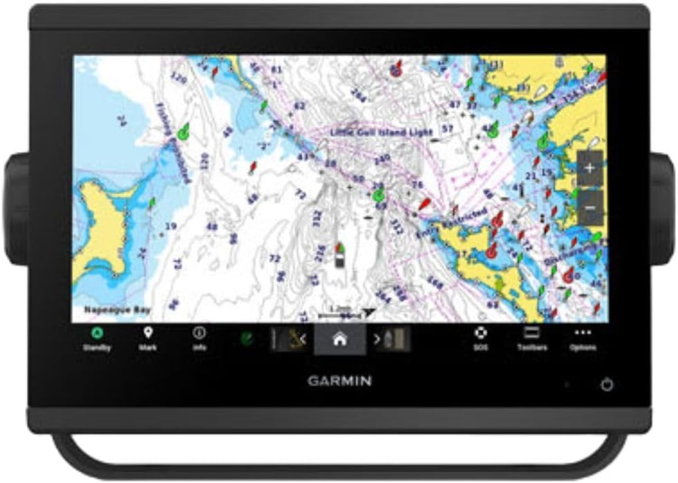
The Garmin GPSMAP 9210 represents the pinnacle of marine navigation technology with a premium 10-inch chartplotter design. It features a full HD display with a glass helm edge-to-edge design for a seamless and modern look. Processing power is up to 7 times faster than previous generations for superior performance and reliability.
We may earn a commission when you buy through this link, at no additional cost to you.
Sailors can enjoy premium features like sailing polars and laylines with Garmin SailAssist features. The device uses the NMEA 2000 and NMEA 0183 networks to connect to autopilots and sensors. Preloaded Navionics+ charts provide comprehensive data, and the unit supports video integration for entertainment.
The inclusion of gigabit speeds on the Garmin BlueNet network ensures stable and fast data transfer across your marine ecosystem. Wireless ActiveCaptain app transfer speeds are enhanced with 5GHz Wi-Fi connectivity. This makes it easier to update charts and manage settings directly from a smartphone.
For owners of larger vessels seeking the best in connectivity and performance, this model is unmatched. The ability to monitor engine performance and control automation systems adds significant value. It is the ideal choice for those willing to invest in a top-tier navigation center.
Enjoy premium sailing features such as sailing polars, plus see laylines, race start line guidance and more with Garmin SailAssist features.
Build extensive networks with reliable connectivity and gigabit speeds on the Garmin BlueNet network for seamless marine system integration.
We may earn a commission when you buy through this link, at no additional cost to you.
The Garmin GPSMAP 79s is a rugged handheld GPS designed to float in water, adding a critical layer of safety for sailors. It features a high-resolution color display with scratch-resistant and fogproof glass for durability. The unit supports multiple satellite constellations for reliable tracking around the world.
We may earn a commission when you buy through this link, at no additional cost to you.
Memory capacity allows you to save and track 10,000 waypoints and 250 routes for detailed journey planning. A built-in 3-axis tilt-compensated electronic compass shows heading while standing still, which is vital for docking maneuvers. The barometric altimeter tracks pressure changes to pinpoint precise altitude.
While it includes a worldwide basemap, it lacks the preloaded coastal charts found in other models requiring extra purchases for detailed coastal navigation. The battery life reaches up to 20 hours in GPS mode which covers most day trips. The floating design ensures that if dropped overboard it remains retrievable.
This model is perfect for sailors who prioritize physical safety and basic navigation tools. The high-resolution display ensures that data is clear even when the weather turns. It is a solid investment for recreational boaters who need a reliable backup that cannot sink.
Supports multiple satellite constellations including GPS, GLONASS, Beidou, Galileo, QZSS and SBAS for reliable tracking around the world.
Built-in 3-axis tilt-compensated electronic compass shows heading while standing still and barometric altimeter tracks changes in pressure.
We may earn a commission when you buy through this link, at no additional cost to you.
The Garmin GPSMAP 943xsv is a powerful chartplotter that combines navigation with advanced sonar capabilities. It features ultra high-definition scanning sonar to help you understand the water environment clearly. Pre-loaded mapping ensures you have immediate access to charts upon setup.
We may earn a commission when you buy through this link, at no additional cost to you.
Support for Panoptix sonar provides detailed views of fish and structure below or to the sides of your vessel. The improved display optics enhance visibility of sonar data even in bright conditions. This device is ideal for sailors who also enjoy fishing or need to scan waters for hazards.
While its primary function is navigation, the sonar integration adds value for those exploring coastal waters for recreational fishing. The high-definition display makes it easy to interpret complex sonar returns without extra processing. It integrates well with existing Garmin marine ecosystems.
For those who want a single device to handle both navigation and underwater scanning this is a strong option. The detailed sonar features complement the chartplotting tools by providing real-time data. It is best suited for sailors with specific underwater monitoring needs.
Ultra high-definition scanning sonar provides clear views of the underwater environment to assist with navigation and fishing activities.
Panoptix sonar support allows you to see detailed views of fish and structure below or to the sides of the vessel.
We may earn a commission when you buy through this link, at no additional cost to you.
The Garmin eTrex 10 is a rugged handheld navigator with a preloaded worldwide basemap and a 2.2 inch monochrome display. It features a WAAS enabled GPS receiver with HotFix and GLONASS support for fast positioning and a reliable signal. The device is waterproof to IPX7 standards for protection against splashes, rain, and immersion.
We may earn a commission when you buy through this link, at no additional cost to you.
It supports paperless geocaching and Garmin spine mounting accessories which can be useful for organizing gear on deck. Power is provided by two AA batteries for up to 20 hours of use. You can see high and low elevation points or store waypoints along a track to estimate time and distance.
While the display is monochrome, the waterproof rating and global basemap make it a dependable tool for basic navigation. The HotFix technology ensures faster position acquisition which is useful when moving quickly between anchorages. It remains a practical choice for entry-level sailors on a budget.
This unit is best for those who need a simple, no-frills device that gets the job done. The IPX7 waterproof standard provides confidence in wet conditions where electronic screens might fail. It is a reliable backup for small sailboats or kayaks where weight and water resistance matter.
WAAS enabled GPS receiver with HotFix and GLONASS support for fast positioning and a reliable signal even in difficult conditions.
Waterproof to IPX7 standards for protection against splashes, rain, and temporary immersion ensuring safety during wet sailing conditions.
We may earn a commission when you buy through this link, at no additional cost to you.
The Garmin eTrex SE offers long battery life of up to 168 hours in standard mode with 2 field-replaceable AA batteries. It features a 2.2-inch high-resolution display that is easy to read even in bright sunlight. Multi-GNSS support gives access to multiple global navigation satellite systems to track in challenging environments.
We may earn a commission when you buy through this link, at no additional cost to you.
You can pair with the Garmin Explore app on your compatible smartphone for wireless software updates and trip planning. It allows you to plot your bearing with a digital compass which provides an accurate heading even when stationary. Hike in any weather with the water-resistant design rated to IPX7.
The standard mode battery life is exceptional for long trips where power is scarce. Active Weather and smart notifications from the app help you stay informed about changing conditions at sea. It is a robust device for budget-focused sailors who need extended operation without charging.
Sailors who prioritize battery endurance and connectivity will find this model highly effective. The digital compass ensures you know your direction without needing satellite signals for every update. It is the ideal budget option for those planning extended voyages on the water.
Get long battery life of up to 168 hours in standard mode and up to 1,800 hours in expedition mode with field-replaceable AA batteries.
Plot your bearing with the digital compass which provides an accurate heading even when stationary for precise navigation.
We may earn a commission when you buy through this link, at no additional cost to you.
Selecting the right navigational tool involves balancing screen size, battery endurance, and specific marine features.
A high-resolution display is critical for reading charts clearly in bright sunlight. Larger screens offer more detail for navigation but require more mounting space.
Prioritize sunlight-readable screens to ensure safety and visibility during active sailing conditions.
Modern GPS devices support multiple constellations like GPS, GLONASS, and Galileo to maintain signal strength in areas with obstructed skies. This ensures you stay on course even near cliffs or large structures.
Look for multi-constellation support to guarantee reliable tracking wherever you sail around the world.
Battery life varies significantly between handhelds and fixed units. Handhelds running on AA batteries often offer 20 to 250 hours of continuous use.
Choose a unit with long battery life to avoid frequent charging during extended trips or remote sailing destinations.
Marine environments are harsh with salt spray and splashes. Look for devices with IPX6 or IPX7 ratings to ensure protection against water ingress.
A rugged floating design is an added safety feature to prevent loss if the device is dropped overboard.
Some units come with preloaded coastal charts while others offer only basemaps. Sailing-specific features like SAILASSIST provide racing tools such as virtual starting lines.
Check if the included maps match your sailing region and if you need specialized sailing tools for your activities.
Advanced chartplotters support network protocols like NMEA 2000 to connect with sensors, autopilots, and radar systems. This integration provides a unified dashboard for vessel monitoring.
Consider how well the device integrates with your existing marine ecosystem before investing in larger fixed displays.
Start by entering your home port or a reference point as your first waypoint. This ensures you can always return to a safe location even if conditions change rapidly.
Regularly update your software and maps to benefit from new features and corrections. Use the companion app on your smartphone to manage these updates efficiently.
Keep the lens clean with a soft cloth to prevent scratches that could obscure your view. Store the unit in a dry place when not in use to preserve battery life and electronics.
A handheld GPS is portable and runs on batteries making it ideal for day trips or as a backup. A chartplotter is a fixed unit mounted on a helm offering larger screens and integration with boat systems.
Many devices come with worldwide basemaps but detailed coastal charts may require separate purchase. Check if preloaded charts cover your sailing region before buying.
Handhelds typically last 20 to 250 hours depending on usage. Fixed units rely on boat power but may need backup batteries for safety during power outages.
Most models are water-resistant with ratings like IPX6 or IPX7. However not all are designed for submersion so check the specific rating for protection levels.
Yes most units include TopoActive maps for hiking and cycling. They work well for shore excursions when you dock at a destination.
Standard GPS tracking does not require a subscription. However some connectivity features like real-time weather may require an app subscription or data connection.
Connect your device to a computer or use the companion app on your smartphone to download and install updates. Keep your device charged during this process.
The Garmin GPSMAP 79sc stands out for its balance of chart coverage and rugged design. It suits sailors who want preloaded coastal maps without the complexity of a large chartplotter.
Consider your primary use case whether it is racing, cruising, or fishing when choosing features. Battery life and display size often dictate convenience more than advanced specs.
Prices and availability vary frequently so check current details before making a purchase. Ensure the selected model matches your specific navigation needs for a safe voyage.